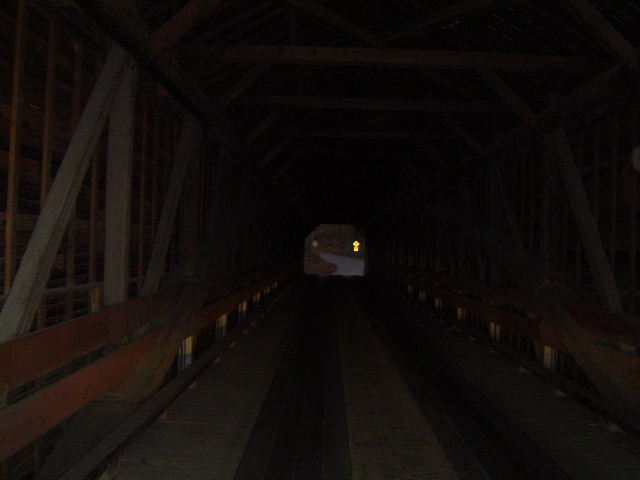
Sunday, December 31, 2006

Appalachia A-La-Carte 12-31-06

Headlines

Appalachian author Wilma Dykeman dies at 86.

Coal industry zeros in on way to strengthen underground seals

Funds called of little use to black lung victims

Burns Creek, Wise County, VA


"Water is a living thing: it is life itself. In it life began."

- Wilma Dykeman

Saturday, December 30, 2006

Weekend Nine: The Good Doctor Walker

The Route of the 1750 Expedition of Dr. Thomas Walker
(Image from the The National Park Service)


I want to introduce another explorer from the age before America was America and before (all) the eastern native American peoples had been driven from their homelands. I first heard his name in association with the geography near my home in Bluefield, attached to two mountains. To the south, defining the edge of what, to my youthful consciousness, was the hinterland of a sort of "Greater Bluefield" was a great old mountain named Big Walker which separates Bland and Wythe Counties in Virginia. Big Walker Mountain, along with nearby Little Walker, is a truly beautiful pile, and is host to a tremendous, if relatively short, scenic byway. Well, as so often with geography (especially on our home turf) I never thought to ask anyone, hey, what or who are the Walker Mountains named after? It was only recently, after a conversation with my wife about Wytheville, Virginia that I even realized I didn't know. Come to find out, the mountains are named after one of the greatest explorers in American history - one who rivals the likes of such great folks as Daniel Boone, Davy Crockett, and the lesser known (but equally intriguing) Henry Timberlake.

Well, there are any number of ways I could introduce you the man named Doctor Thomas Walker, a man who was a friend and confidant of Thomas Jefferson and who discovered the Cumberland Gap (long before it had a European name). But, it being the weekend, and there being a plethora of great bowl games, not to mention the fact that everything I'd be telling you would be, essentially, a quote from someone else's website, well, I think it is time for a glut of links, accentuated by an equally delightful glut of quotes. Huzzah!

1) Journey Through Hallowed Ground: A National Register of Historic Places Travel Itenerary Along Route 15 in Virginia's Piedmont: Castle Hill:

Here in 1781 Walker's wife delayed the British colonel Banastre Tarleton to give the patriot Jack Jouett time to warn Thomas Jefferson and the Virginia legislators of Tarleton's plan to capture them.

2) National Park Service: Dr. Thomas Walker:

Walker developed great skill and reputation as an explorer and surveyor and in 1743 led an expedition as far west as present-day Kingsport, Tennessee. In March 1750, he led another expedition through present-day Kentucky that lasted four months. Click here to see the path of the expedition. It was during this expedition that Walker discovered Cumberland Gap and recorded its existence in his April 13th diary entry:

"We went four miles to large Creek, which we called Cedar (Indian) Creek, being a branch of Bear Grass (Powell's), and from thence six miles to Cave Gap (Cumberland Gap), the land being levil [sic]. On the north side of the gap is a large Spring, which falls very fast, and just above the Spring is a small entrance to a large Cave (Cudjo Cavern), which the Spring runs through, and there is a constant Stream of cool air issuing out. The Spring is sufficient to turn Mill. Just at the foot of the Hill is a Laurel Thicket, and the Spring Water runs through it. On the South side is a plain Indian Road… This Gap may be seen at a considerable distance, and there is no other, that I know of, except one about two miles to the North of it, which does not appear to be so low as the other."


3) Dr. Thomas Walker Kentucky Historic Site:

A physician and surveyor, Walker led the first expedition through Cumberland Gap in 1750. Dr. Walker was an agent for the Loyal Land Company of Virginia and was exploring the western wilderness seeking land for settlement. Near the river, which he named the Cumberland, Dr. Walker built the first cabin in Kentucky, a replica of which stands on the site today. Dr. Walker’s journal, recorded during his four-month exploration, described plentiful wildlife, thickly tangled woods and rugged terrain.

4) Sandi Gorin (on Rootsquest) "The Famous Walker Line":

In 1776 the Virginia House of Delegates defined the northern boundary
of the Kentucky District as the low-water mark at the mouth of the Big
Sandy, on the northern shore of the Ohio River. This boundary followed the
Big Sandy River from that point to the junction of the Tug Fork, and from
there up to the Laurel Ridge of the Cumberland Mountain to the point where
it crossed the Virginia-North Carolina line (known as "seven pines and two
black oaks). When Virginia agreed to separate Kentucky in the Compact of
1789, that description was accepted.

In 1779-80, The Virginia-North Carolina dividing line was extended
westward to the first crossing of the Cumberland River. From this point
west to the Mississipppi, Thomas Walker surveyed the line for Virginia.
This took him through dense forests, over rugged mountains - a most
difficult task. According to R S Cottrill, in an article dated 1921, this
line almost immediately caused a tremendous amount of dispute for many
years between Kentucky and Tennessee. When Kentucky became a state in
1792, it immediately began to "find fault" with the line as drawn by
Thomas Walker in 1779.


5) Virginia is for Lovers: Thomas Walker Old Fashioned Days (in Ewing, Virginia):

Thomas Walker Old Fashioned Days will be held at the Thomas Walker High School parking lot in Ewing. Join us for a celebration of frontier heritage including crafts, craft demonstrations, children's games, beauty pageant and great home cooking.

6) Albemarle Adventurers: Thomas Walker:

He also had great influence in dealing with Indian affairs. Walker represented Virginia at the Treaties of Fort Stanwix and Lochaber and dealt with the peace negotiations after the Battle of Great Kanawha. In 1775, Walker served as a Virginia commissioner in negotiations with representatives of the Six Indian Nations in Pittsburg.
(Be sure to check out all the sub-links on this one)

7) The Kentucky Highlands Project: Journal of Doctor Thomas Walker:

28th We kept up the River to" our Company whom we found all well, but the lame horse was as bad as we left him, and another had been bit in the Nose by a"Snake. I rub'd the wound with Bears oil, and gave him a drench of the same and another of the decoction of Rattle Snake root some time after. The People had built a house 12 by 8, clear'd and broken some ground, and planted some Corn and Peach Stones. They also had killed several Bears and cured the Meat. This day Colby Chew and his Horse fell down the Bank. I Bled and gave him Volatile drops, and he soon recovered.

April 29th. The Sabbath. The Bitten Horse is better. 3 Quarters of A mile below the house is a Pond in the Low ground of the River, a quarter of a mile in length and 200 yds. wide much frequented by Fowl.

30th. I blazed a way from our House to the River. On the other side of the River is a large Elm cut down and barked about 20 feet and another standing just by it with the Bark cut around at the root and about 15 feet above. About 200 yards below this is a white Hiccory Barked about 15 feet. The depth of the water here, when the lowest that I have seen it, is 7 or 8 feet, the Bottom of the River Sandy, ye Banks very high, and the Current very slow. The Bitten horse being much mended, we set off and left the lame one. He is white, branded on the near Buttock with a swivil Stirrup Iron, and is old. We left the River and having crossed several Hills and Branches, camped in a Valley North from the House.

May the 1st. Another Horse being Bitten, I applyed Bears Oil as before Mention'd. We got to Powell's River in the afternoon and went down it along an Indian Road, much frequented, to the mouth of a Creek on the West side of the River, where we camped. The Indian Road goes up the Creek, and I think it is that Which goes through Cave Gap.

8) Bell County (Kentucky) Historical Society: Thomas Walker 250th Anniversary of Walker's Discovery of the Cumberland Gap:


9) Library of Congress: The First American West: The Ohio River Valley, 1750-1820:

When European Americans first entered the western country, they were intrigued and puzzled by numerous mounds and earthworks found in abundance along rivers and highlands. As early as 1750, Dr. Thomas Walker noted earthworks at the head of the Cumberland River in Kentucky.


One other note: Thomas Walker was one of the first three Virginians to import English hounds and took part in the early breeding of coon hounds in the Blue Ridge mountains. . . I don't know much more than this, but I'm a'looking.

Wednesday, December 27, 2006

Christmas in Appalachia

"...and Lord I'm goin' home." -Bill Monroe

The Maynard Johnson Farm, near Horse Creek.


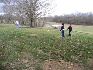
Cousins playing football.


The Christmas Tree, just after sun up.


The sun sets on Christmas 2006.

Saturday, December 23, 2006

Route 11 North: Dublin, VA to Elliston, VA

Filling in the gap of our now-four-part photo essay of Lee Highway, aka Route 11, between Knoxville, Tennessee and Mount Jackson, Virginia, I've back-tracked a bit because the sunset picture of the Draper Mountain Overlook at Pulaski didn't do the view justice. So, we'll start off there looking to the north at Cloyds & Little Walker Mountain in the background.

The first sign of civilization that you see as you drive down Draper Mountain into Pulaski is Calfee Park, most recently home to the Blue Jays of the Appalachian League. Unfortunately, Pulaski is once again team-less. Another town courted the Blue Jays away with better facilities and the promise of better attendance than what Pulaski provided.

A view of downtown Pulaski. Once a thriving business district, it has fallen victim to textile and furniture plant relocations over the past 25 years, the end of the railroad era and being by-passed by Interstate 81. Pulaski Furniture still is in operation on the edge of downtown but the number of people it employs is far below what it has been in the past.

The next town along the journey is Dublin. Rumor has it that it's the fastest growing town in the Commonwealth (it's Dublin everyday!). The train station hasn't been in service since N&W stopped passenger rail service but several investors have renovated over the years. It's currently for sale if anyone here is interested. It's also on the site where Union troops in the Civil War destroyed a munitions depot and tore up the tracks leaving sites to east without easy access to the salt mines of Saltville,Va and bringing troop movement along the rails to a halt. For more on that element of the Civil War, follow this link to the Battle of Cloyd's Mountain.

Route 11 leaves Pulaski County and enters the City of Radford when the road crosses the New River. Travelers have been able to cross the river span since 1891. Before then, people were pulled across the river using the Ingles Ferry, Dudley Ferry or Peppers Ferry.

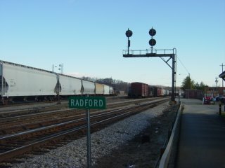
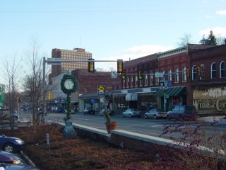
At one point in time, the powers that be within the railroad company needed a place to manufacture rail cars and steam locomotives. Two sites in western Virginia were in the running for the facility, Radford and Roanoke. Of course, the Roanoke site was chosen and the city grew by leaps and bounds because of it. Radford served as a refueling and watering center for trains that had just chugged up Christiansburg Mountain from Roanoke en route to Bristol, Bluefield and Hinton. A view of downtown Radford and Radford University.

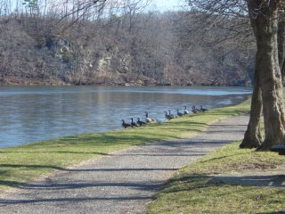
A view of geese along the New River at Radford University's Dedmon Center


The Montgomery County Courthouse in Christiansburg might be the ugliest courthouse in the Appalachian region, if not the country.

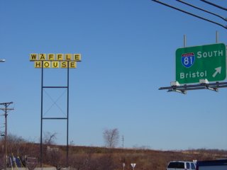
Route 11 intersects Interstate 81 again at Christiansburg. This might also be the only place that you can find a Waffle House, an American Institution™, along the old road south of Lexington. This particular part of Route 11 is at the top of Christiansburg Mountain, where you leave the Gulf of Mexico watershed and enter the Albemarle Sound watershed. Waters to the west flow into the New River and waters to the east flow into the Roanoke River.


"The Straightaway" is a 1.8 mile stretch of perfectly flat and straight road between Shawsville and Elliston. Route 11 bisects the flood plain of the South Fork Roanoke River in this rich farmland. I have worked with two people that were raised in this area, one in his 60's and one in his 30's. Both have some good stories of the races that took place on this road in their youth.

Lastly, the moment before the battery on my camera died, The Roanoke River Wayside.

If not for a dead camera, I had planned to connect the dots all the way to Troutville but it's probably for the better. Visiting the busy streets of downtown Salem and Roanoke the weekend before Christmas would have left me needing some moonshine to calm my nerves. I'll leave that section for another day.

Virgil Goode

Thomas Jefferson, Former Resident of What is Now Virginia's 5th District,
Whose Self-Written Epitaph Stated:
Here was buried Thomas Jefferson Author of the Declaration of American Independence ,Of the Statute of Virginia for religious toleration, & Father of the University of Virginia.
(Via the Library of Congress)


I don't really want to have to comment on Congressman Goode's (the 5th District of the Commonwealth of Virginia, which takes up much of the Shenandoah Valley and Blue Ridge Mountains) remarks - my stomach turns a bit every time I think of them. But frankly, it needs to be done. So here goes.

First, let's take a gander at the letter he sent out to his constituents that sparked the entire controversy (via the Richmond Times-Dispatch):

Dear . . . Thank you for your recent communication. When I raise my hand to take the oath on Swearing In Day, I will have the Bible in my other hand. I do not subscribe to using the Koran in any way. The Muslim Representative from Minnesota was elected by the voters of that district and if American citizens don't wake up and adopt the Virgil Goode position on immigration there will likely be many more Muslims elected to office and demanding the use of the Koran. We need to stop illegal immigration totally and reduce legal immigration and end the diversity visas policy pushed hard by President Clinton and allowing many persons from the Middle East to come to this country. I fear that in the next century we will have many more Muslims in the United States if we do not adopt the strict immigration policies that I believe are necessary to preserve the values and beliefs traditional to the United States of America and to prevent our resources from being swamped. The Ten Commandments and "In God We Trust" are on the wall in my office. A Muslim student came by the office and asked why I did not have anything on my wall about the Koran. My response was clear, "As long as I have the honor of representing the citizens of the 5th District of Virginia in the United States House of Representatives, The Koran is not going to be on the wall of my office." Thank you again for your email and thoughts.

Sincerely yours,
Congressman Virgil Goode
I am not going to comment on the fact that the Congressman obviously believes that the separation of Church and State is really just a vague suggestion, and that the religion should be Christianity (probably whatever denomination he adheres to at home) - that said, he has the right to hang whatever he wants in his office - see, Representative, rights work both ways. And I'm not going to comment on the fact that apparently the Congressmen did not realize the representative to the United States is not a naturalized immigrant, but an American by birth who can trace his family's roots into the 18th Century. I will say that he has obviously decided he does not like Muslims and wants no more of "those people" here - reminds me of the insults that used to be levied against folks like the Irishmen in my family. It is called bigotry, and I am horrified that a member of Congress from Appalachia is apparently proud of his. I hope the readers and writers in this community agree.
What I want to point out are a couple of key points. First, in the United States no citizen can be required to swear an oath, and no citizen can be required to swear or affirm on a religious text. This logic was worked into the earliest drafts of the Constitution and its predecessor documents in order to guarantee its support by Pennsylvania Quakers. Second, Jews in the Union have long often sworn on the Torah or extended Hebraic scriptures, Muslims on the Quran, Roman Catholics on Bibles with the Apocrypha, Mormons on the Book of Mormon, and so on - why? Because the act of "swearing", while political and legalistic, is also intimately private - legally you are swearing to the state - in choosing a religious text of your choice (or the absence of one) you are personally swearing to whatever being, beings, and/or traditions you personally revere. Again, it is religious freedom, Representative Goode.

Also, the defenders of Goode keep referring to the Jewish and Christian roots of the American political system. I'm afraid this is where they're fairly sadly mistaken. The American social system, and indeed, to a degree, the American economic system is largely based on Jewish and Christian roots. But the American political system is based almost entirely on pre-Christian, polytheist Greek and Roman political institutions and philosophy, institutions and philosophy that Christian Medieval Europe would likely have forgotten were it not for the efforts of Islamic, predominately Arab, scholars. Of course, our bureaucracy is largely based on the principles of the Chinese bureaucracy, filtered through those Greek and Roman roots, and our military is heavily influenced by native American and Mongol ideals (as well as, of course, Greek and Roman pre-Christian), but who am I to split hairs. The exception? The one place in American government that is heavily influenced by traditional Christian political philosophy? The American welfare system so generally reviled by most folks who want a Christian theocracy in the Union. Now, that's not to say that Christianity and Judaism don't have a hugely important place in the our nation, cause they do. But our political system is based on pragmatic concepts, not ideological or theological precepts - that is why people who disagree as much as all the various religious groups in our wonderful nation CAN disagree and still be politically great.

Oh, and Representative Goode, no one is trying to make you or anyone else swear on a Quran - quit acting like you're brave for not doing so.

To end, I just want to recommend the literature written by a gentleman who, were he alive today, would reside in Goode's district - his name was Thomas Jefferson, and he was from a nice hill-town of Charlottesville. After all, it was Jefferson who wrote the Bill for Religious Freedom, which made the Commonwealth of Virginia (then containing West Virginia and Kentucky) the first secular state in the history of humanity.

Friday, December 22, 2006

We Are Marshall

November 14, 1970...seems like a normal date. But is was a date to change the city of Huntington, the state of West Virginia, and a lot of sports fans everywhere. That was the day 75 people including most of the Marshall Thundering Herd football team died in a plane crash near Huntington. From the official report...

Southern Airlines Flight 932 left Kinston, North Carolina, at 6:38 p.m., carrying the Marshall University football team, coaching staff and fans to Huntington, West Virginia. After an uneventful flight, the crew contacted Huntington Airport tower at 7:23 p.m. and were cleared for a localizer approach on runway 11. The weather conditions were poor, mist and light rain with broken clouds at 500 feet. The plane descended below the Minimum Descent Altitude, striking trees on a hillside about one mile from the runway. The plane then crashed and burned.
I was 12 at the time. In the sixth grade. And growing up in Oceana, Wyoming county, West Virginia. I don't remember hearing about the crash. I don't recall even knowing about Marshall University. Sadly, for me there are no memories.

Ironically, in the fall of 1976, I would be a freshman at Marshall. I would pass by the Memorial Fountain outside the student center, and it would be just a fountain. I had no idea of the meaning. Even after 4 semester at Marshall, staying in 606 Twin Towers East, the full magnitude of the accident, just a few years earlier, never registered. It was never talked about.

But looking at the info on those who died causes me to think about how bad that day must have been. The people who came together in 1971 to rebuild the football program, were gone by the time I arrived in 1976.

The pilot, was a veteran of World War II and Korea. He had 18,500 hours logged as a pilot. Considering that I work a 40 hour week, this pilot had the equivalent of 9 years of flying 40 hour per week. He was experienced. From the report, the most likely causes were...

he Board has been unable to determine the reason for this descent, although the two most likely explanations are: a) improper use of cockpit instrument data; or b) an altimetry system error”

Even if I don't remember the actual event, I can understand the sorrow cause by of this crash.

I transferred from Marshall after 2 years and finished up at another school. But now, through this movie, I have grown closer to one of my old schools. In all this time, I never understood the magnitude of the crash, now I understand it better.

If possible, I will see "We Are Marshall" on the big screen.

The Weekend Five: The Return of ETSU Football

The Once and Future East Tennessee State Buccaneers
(Photo from Buc Football & Friends Foundation,
a Great Site Worthy of Substantive Inquiry)

East Tennessee State University played its final football game in November of 2003 - right after they first appeared on their first video game, by the by. I never saw ETSU play live, but I did see a few of their games on the old tube, and I will definitely say it makes me sad to see any school have to shut an athletic program down by reason of inadequate funding (tears in heaven). Today something happened - Buc football is back. Probably.

1) Kingsport Times-News - "Stanton Supports Bringing Football Program Back to ETSU, Millions in Funds and Board of Regents Approval Still Needed"

2) East Tennessee State Athletics - Football Retrospective Page

3) Buc Football & Friends Foundation

4) Bristol Herald Courier - "ETSU President Supports the Return of Football"

5) ETSU Football Task Force Report

I'm sure we'll be back to this one soon - Mr. Kerns, I'm looking at you.
Merry Christmas, Happy Hanukkah, and Feliz Futbol Notreamericano.

Thursday, December 21, 2006

Dr. Ralph Stanley and the Clinch Mountain Boys at the Birchmere


I had the opportunity to see the December 16 concert at The Birchmere with my wife Emily. The concert was enjoyable, although the band seemed a little full of themselves at times. Ralph sang on a majority of the songs, but sat a few out. He said he'd overdone it the night before. A real treat was when he played the old claw hammer style on the banjo.

A partial set list included:

O Death
Rank Stranger
A Robin Built a Nest on Daddy's Grave
I’ll Fly Away
Pretty Polly
Sandy Ridge
Mary Merry Christmas
Orange Blossom Special
Mountain Dew (Last two were best of night in my opinion)

A considerable amount of time was spent promoting merchandise, which the band shamelessly admitted, but I felt it detracted from the show a bit. The "Play It And They Will Buy" approach seems like it would work better.

Overall, it was good music and another great opportunity to see a legend play live.

Emissaries of Peace: 1762 Cherokee & British Delegations

Exhibit Poster From the University of Tennessee's Frank H. McClung Museum
I just wanted to let everyone know about a really fantastic museum exhibit that I visited today on a whim, much to my pleasure. The exhibit is all about British attempts to forge alliances with the Cherokee people against French-allied nations while simultaneously exploring the Tennessee, Wautaga, Clinch, and Holston river valleys in east Tennessee. The exhibit centers around the experiences of a British Officer by the name of Henry Timberlake and three Cherokee leaders, led by the well-known warrior Ostenaco, juxtaposing their experiences. Timberlake spent an extended time living with the Overhill Cherokee, whereas Ostenaco and his peers spent an extended period in England, even meeting with King George III. That said, the exhibit avoids overemphasizing the trivial - quite the contrary, it uses the experiences of Ostenaco and Timberlake to highlight the international politics of age, a time when the native American nations still were major players on the continent, when the England's hold over the Thirteen Colonies remained in doubt, when the military and political figures who would play an essential role in the American war of secession cut their teeth, and when the northern native American nations created such enmity amongst the British-American colonists that their permanent enmity was assured. Not to mention the cultural artifacts, civilian and military.

Well, I've said enough - I certainly don't want to spoil the exhibit for you. But I do want to drop you some knowledge and a few relevant links.

First, the show is no longer (as far as I can tell from their homepage) available at the primary sponsor, the Museum of the Cherokee Indian (Cherokee, North Carolina), but considering its quality, I wouldn't be surprised if it made a return trip. If you care to see it, then, you're either going to have to hit Knoxville's McClung Museum on the campus of the University of Tennessee (the show will be up through February of 2007) or the Smithsonian Institution's National Museum of American History (Spring of 2007).

Second, I want to point you to a great book (I'm tearing through it since I bought it at the exhibition): Memoirs by Henry Timberlake (annotated by Samuel Cole Williams, LL.D.), republished by Mountain Press. This travelogue and memoir is not only a fascinating look at the Cherokee and pre-European settlement Appalachia, it is a great read, good literature for the sake of good literature. Mountain Press is selling the book for $20, which may seem a little pricey, but remember, you're supporting a small press, and that in and of itself is a good thing. I'd say make it a Christmas/Hanukkah present, but it is a little late in the game. So, make it a New Year's present. Yeah. That.

Wednesday, December 20, 2006

Route 11 North: Troutville, VA to Mount Jackson, VA

This post continues the road trip started by Eric's post on 11W from Knoxville to Abingdon, and Mike's post on Route 11 from Abingdon to Dublin, VA. I picked up Route 11 just north of Roanoke in Troutville, VA, tuned in Bluegrass Junction on my XM dial, and headed north.


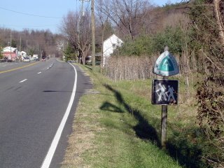
Route 11 is again crossed by the Appalachian Trail just south of Troutville.


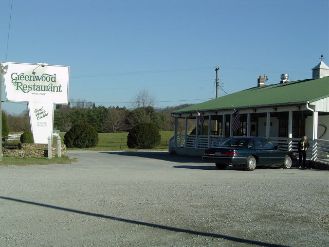
For some good home cooking, the Greenwood Restaurant is the place to stop; complete with a train that circles overhead in the dining room!


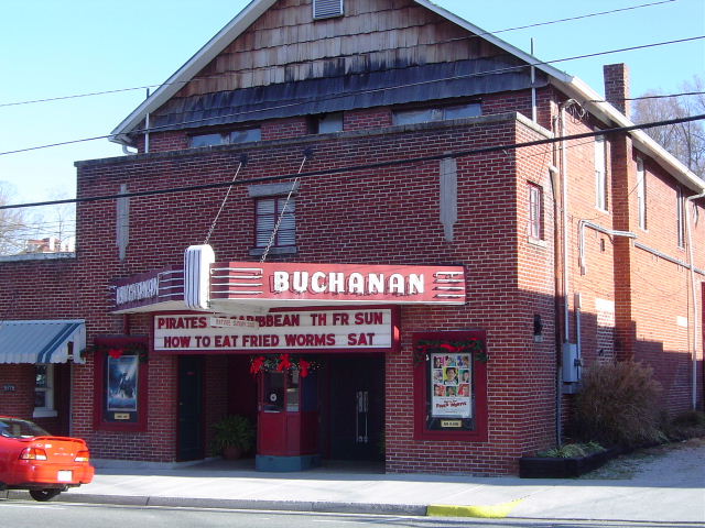
Located between Purgatory Mountain and Cove Mountain right on the James River in Botetourt, County is Buchanan, Virginia.


It is worth a stop and has plenty to offer, including a theater, many boutique shops, restaurants, and coffee shops.


And it's famous for the swinging bridge that crosses the James. You have to go over it at least once.


Natural Bridge in Rockbridge County offers an eclectic mix of things to do. The bridge itself is the main draw, but unfortunately, you have to pay to see it. The hotel offers quality accomodations, and personally speaking, is a great place for a wedding reception. There's also caverns, a wax museum, a zoo and a safari park nearby.


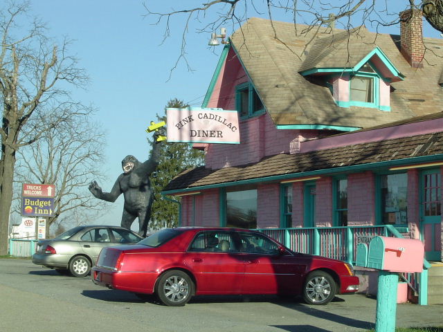
If you need a burger along the way, the Pink Cadillac's Elvis Burger is sure to satisfy.


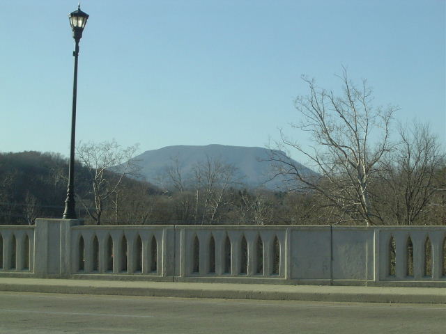
House Mountain is seen in the background as you cross the Maury River in Lexington, VA. For those with time to kill, take Business 11 into the heart of town. Washington and Lee University and Virginia Military Institute are here, along with too many good restaurants and stores to list them all. Also, a neat venue called Lime Kiln Theater is here.


A rare sighting these days, Lexington still has a drive-in, located just north of town.


Rt. 11 passes through several small towns north of Harrisonburg. New Market, VA is the first.


The Shenandoah Valley is a principal agricultural area in Virginia. Route 11 passes by many farms tucked right against the Blue Ridge Mountains.


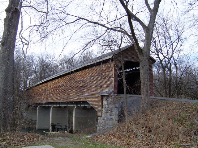
Be sure to make a stop at the covered bridge between New Market and Mount Jackson.


It is a single lane bridge, so make sure nothing is coming before you start through.


Not much daylight left on this travelogue, but enough to capture in the sunset the steeple of the Hawkinstown United Methodist Church and the watertower at the Bowman Apple Products plant just north of Mount Jackson.

Southwest Virginia's New Conservation Easements

1/5 of Burkes Garden in Tazewell County, Virginia is now protected from logging and development.

An additional 4,900 acres are now preserved from development in Giles, Pulaski and Tazewell Counties. Story from the Roanoke Times.

More on conservation easements and their environmental and economic benefits from the New River Land Trust and the Virginia Outdoors Foundation.

Tuesday, December 19, 2006

Huguenots, Pressure Cookers, Liquor, Chicken, Thermonuclear Weapons, the Autobahn, and the City of Corbin

Colonel Harland Sanders, Chickenlord of Kentucky
(Image from Alice J. Schleicher, Inc., a Kentucky Fried Chicken Franchise Holder in Indiana, Kentucky, Tennessee, & Alabama)
We start in France.

Denis Papin was a French Huguenot and a scientist in the late 17th and early 18th Centuries. Before he disappeared in Britain sometime after 1712 (not to spread rumors, but he was destitute, an refugee from the French monarchy, and a political enemy of Sir Issac Newton [who, of course, died from mercury poisoning, a product of his obsession with undermining counterfeiters and alchemy]), he was deeply involved in research on the use of steam driven mechanics, specifically for the purpose of powering engines. A side effect of Mr. Papin's research was a device he called a steam digester - a unique machine that increased, within a given space, atmospheric pressure to such a degree that some of the physical properties of matter within said atmosphere changed. The practical upshot of this was that organic matter placed into such a high-pressure device cooked far more rapidly than it ordinarily would, often three to five times as fast.

Today we call these apparatuses pressure cookers, and they form the basis of two of Appalachia's most famous exports - one legal, one illegal. As to the latter, well, its called liquor. Whiskey to be specific and moonshine whiskey. As to the former? Well, read on.

A century after the good Mr. Papin mysteriously vanished from public record in Britain, the British Empire would find itself deep amidst a major war against a federation of thirteen of its former colonies (and several of their own colonies) - the United States of America. While the war had many causes, all of which are debatable, the war itself was seen by both combatants as an opportunity to grab invaluable territory. The US hoped it would be able to invade and capture Canada, effectively doubling its territory, whereas the British hoped to capture the Northwestern Territories, now the American Midwest, at the least, and possibly other territories contemporaneously under American control.

To state the outcome simply, Canada remained British, and the Midwest remained American, and the power of native American tribes in the Midwest and Southeast that had supported the British was effectively minimized to the point that their negotiating abilities with the Union were virtually nil.

While many of the state militias had performed ineffectively during the War of 1812, those on the frontiers, notably those of the Indiana territories and the Commonwealth of Kentucky, were considered to be surprisingly effectively.

Time for a quote from the Honorable Order of Kentucky Colonels:

The title Kentucky Colonel has been around since 1813. The Kentucky Militia had just returned from a highly successful "War of 1812" campaign that resulted in control of the Northwest being returned to the United States. When the militia disbanded, Governor Isaac Shelby commissioned Charles S. Todd, one of his officers in the campaign, as an AID-DE-CAMP on the Governor's Staff with the rank and grade of Colonel. Todd married Shelby's youngest daughter two years later.

Early Colonels actually served military roles. In the latter part of the 1800's, the position took on a more ceremonial function. Colonels in uniform attended functions at the Governor's mansion and stood as symbolic guards at state events. By the late 1800's, the title had become more of an honorary one. In the late 1920's, a group of Colonels started talking about forming a "society". Governor Flem Sampson gave his blessings to the project. Late one Saturday afternoon in May of 1931, the first meeting of what would eventually become the Honorable Order of Kentucky Colonels was held in Frankfort.

"Formulate a society to more closely band together this group into a great non-political brotherhood for the advancement of Kentucky and Kentuckians," Governor Sampson challenged. And they did. Minutes of the early meetings confirm that charitable programs were to be a central part of the organization. Social events would also play an important role. "The Kentucky Colonels" held a Derby Eve dinner for the first time in 1932.

Ruby Laffoon, who seemed to have had an innate sense of Public Relations and an affinity for Hollywood stars, replaced Sampson as Governor in 1932. Not long after taking office, Laffoon met with Colonel Anna Bell Ward Olsen who owned several movie theaters across Kentucky. A representative of theater owners nationwide, who also held a Kentucky Colonel commission, accompanied Colonel Olsen. The meeting theoretically concerned movie censorship. However, what came out of the meeting was a "new" organization to be called the Honorable Order of Kentucky Colonels. Laffoon appointed Colonel Olsen as Secretary and Keeper of the Great Seal.
Got all that? Of course you do. The War of 1812 led to a close association between a militia colonel and a governor. The governor then started using militia colonels as an elite honor guard at state events, then started appointing the title of "colonel" as an honorific. Ultimately, amidst the Great Depression and, one might assume, McCarthyism, the Colonels "organized" and transformed into a kind of honorific service fraternity.

One of the most famous of these honorary colonels, indeed, almost definitely the most famous was not born in Kentucky at all, but in Henryville, Indiana (which was, however, named after a Colonel), just on the north side of the old Ohio. Through a series of adventures (including military service - as a private - in Cuba) and jobs, Harland David Sanders ended up in the town of Corbin in southeast Kentucky. There he opened a service station, located to take advantage of the convergence of several highways in the small city.

What did the good Mr. Sanders do, exactly, to warrant his ascension to Kentucky knighthood? A good question, and one that is relatively easily answered. He sold chicken.

At around the age of 40, at about the same time as the Honorable Order of Kentucky Colonels was founded, Mr. Sanders decided to supplement his Depression-era income by frying chicken which he served in his home, attached to the service station. Apparently, it was delicious, and Mr. Sanders' product became increasingly popular, popular enough, in fact, that he was ultimately able to expand his holdings from a simple service station to a service station, motel, and restaurant. Three years after the foundation of the Order, Mr. Sanders became Colonel Sanders, nominated undoubtedly for his business acumen and his local popularity.

Time passes, as it always does. The Great Depression ravaged not only the United States, but also most of the rest of the developed world, including recently defeated Germany, where, of course, Mr. Papin's wife lived after Mr. Papin pulled his Bermuda Triangle event. Indeed, the desperation in Germany was so great that it created space for the rise of arguably the most horrifying political system in human history - the Nazi regime.

The meteoric rise of the good Colonel Sanders would, indirectly, be a consequence of the American war effort against this regime. You're incredulous. I know. That's natural. Keep reading.

Colonel Sanders decided to begin the process of franchising his now famous chicken and its 11 secret ingredient recipe (finally developed after trial and error by 1940) in 1952. . . . a lucky break for the business owner, since less than three years later the Colonel would be forced into selling his real estate via the magic of eminent domain - the Federal government had decided to build Interstate 75 through east Kentucky, and the Colonel's holdings were right on the path.

This warrants a pause - did the Colonel know in 1952, three years before the government formally finalized their plans for the I-75 route and fully eight years before ground was broken that he would have to seek capital from an alternative source? Ordinarily I would assert, probably not, but we must remember that he was a member of an organization that, while it does many wonderful things, it also serves as a means of establishing political, social, and economic relations connections between the Commonwealth of Kentucky's elite (and elites from a great many other places as well). One has to wonder if his connections might have prompted him to pursue an expansion of economic activities early - not that I blame him at all, of course, but there it is. His efforts to franchise only increased in 1955 when he received his first social security check and sold his holdings - he used the capital to pay off all his remaining debts and dove headfirst into making Kentucky Fried Chicken a household name - everywhere.

But we've strayed, left an open ended plotline, an intellectual hangnail. What about the Nazis, the Second World War? Well, while most Western states had embraced to a lesser or greater degree the Roman concept of national highway systems, systems of standardized highways that would allow for the movement of massive human and physical resources across great distances easily, without the need for centralized planning - the utility of which for both civilian and military purposes manifest. During the American invasion of Germany one General Dwight D. Eisenhower (not to mention a great number of other future political leaders), soon to be president of these United States, saw the utility of fully modernized highways systems, such as those first propagated on a wide scale by the Nazi party in the Autobahn, and upon his taking office, would become an advocate of the development of an even more developed interstate system (with wider lanes, straightaways for emergency airfield use, lower grades in order to facilitate military and commercial use, and so forth). The importance of interstates swelled again with the onset of the Cold War - a mobile military system and resources was considered essential if the United States was to survive a Third World War against the Soviet Union - one in which being able to logistically dance around thermonuclear weapons was essential. And these weapons, of course, represent the second way in which the Nazis contributed to the rise of franchised KFC - it was Nazi engineering, both on nuclear devices and delivery systems, appropriated and improved by the Americans and Soviets, that would help necessitate the rise of the interstate system that would force the Colonel to reconsider whether he should be an entrepreneur of only one or a few restaurants, or take a different course.

Ah, but what made all this possible? Papin. That's right. Our dead, missing Frenchman. The Colonel, as far back as the 1940s, did something truly innovative. He employed a Papin's pressure cooker in the act of fried chicken, thereby allowing what had previously been a much more time-intensive activity (usually 45 minutes from start to finish) to be accomplished quickly, for the first time transforming a traditional Southern food into fast food.

Part of the brilliance of Colonel Sanders, of course, lies in his marketing - he didn't just see chicken, he sold himself. Not physically, of course. That's illegal everywhere but Nevada. No, he sold his image, a hyper-Southern gentleman, donning a white suit and black string tie, his friendly manner, and his witty quips ("It's fingerlicking good!"). KFC, especially while the Colonel was alive, was intended to be an experience - sure, a 30 minute long experience, but an experience nonetheless. The Colonel became as much a visual icon as an ideographic one. Doubt it? Well, consider the timing of Eastern Kentucky University's adoption of its current mascot:

The earliest known university nickname is the "Maroons," which came from the school colors of maroon and white. The Maroons name became associated with the school during the '20s and continued for roughly 40 years. During a brief time in the late '20s the student population voted to accept the Leopard as the official school mascot. Students in fact had a plan to purchase a leopard from the zoo in Memphis, Tenn., but it was not pursued and Maroons continued to remain the official mascot until 1963. During this time several beloved campus dogs, most notably Mozart who is buried behind the Van Peursem Pavilion in the ravine, unofficially served as mascots. In 1963, President Robert Martin decided that the school needed a "real" mascot and began looking for a new symbol for our university. The Kentucky "Colonel" was decided on as the symbol.

Officials at Centre College in Danville were upset with Eastern's new mascot, since their athletic teams were also called the Colonels. But the name stuck and the Colonel became Eastern's official school mascot. The first Colonel mascot appeared at an October 1964 football game and the tradition has remained ever since. Today's Colonel caricature is modeled after a 1967 drawing that appeared in the Louisville Courier Journal by nationally prominent newspaper cartoonist Hugh Haynie.

Intriguing, eh? Ah, to be a meager imitation of James Burke.


PS - If you want to become a Chickenlord and truly embrace the Colonel, you must visit two places. First, the Free World Chicken Festival in London, Kentucky (so awesome) and, of course, the Harland Sanders Cafe & Museum in Corbin, Kentucky.

PPS - I am not yet a Chickenlord or a Colonel. Yet.
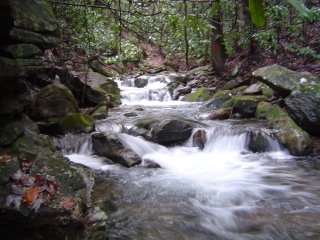
Sunday, December 17, 2006

Do You Speak American: IMing in Appalachia

I just wanted to shoot out this interesting article to everybody - it is completely worth two or three minutes. Specifically, its an NPR article on how black students in rural, western North Carolina reiterate their African American identity by employing certain accent and slang terms and phrases, even while instant messaging. I find this sort of analysis significant because it really hits at how Americans in general and Appalachians in particular utilize their accents, consciously and unconsciously, to define their in and out groups and to enhance their personal self-worth. Just interesting food for thought.

Saturday, December 16, 2006

Weekend Five: Maps

The Cherokee Overhill Towns
(as taken from Henry Timberlake’s book, and featured on the TNGenNet Map Project, which I recommend Below)

The mapping of planet is one of humanity's oldest scientific activities. By scientific, I should say, I mean a systematic effort to describe the observable world. Of course there are pragmatic ends to cartography . . . without it, managing real estate (up until recently the only truly durable form of wealth) becomes infinitely more difficult, navigating the land or sea becomes treacherous, and the construction of anything larger than a small home becomes perilous. And maps are responsible, to a large extent, for defining the identities of most people on this planet - if you doubt that sentiment, consider that most states had at best ill-defined borders until the late 17th Century at the least, and for some states until the 20th Century, and consider further that these borders generally are artificial - if you were German and caught (finally) in France, well, you learn French. And vice-versa. We needn't even get into what maps do for the egos of "great" nations either - all you have to do is look at a map of the world during one of the two great waves of colonialism and remember how proud that would make the average European or North American - whose wallet it was draining - to see their appropriate color spreading across the map (Red for Britain, Blue or Purple for France, Orange for Germany - oh, you know the principle, you've played Risk).

All that said, what I like, honestly, is the artistry of maps. I love the elegance of a well-made map, the way that they seem to hold stories. They remind me of pirates and of hobbits and other assorted literary genre. I know. I'm a nerd. Such is life. All this said, I decided to dig up five sites for those cartophiles out there who also happen to be fans of the Hills. So here we go.

1) Appalachian Regional Commission Data and Research Maps: Tons of socioeconomic and environmental maps with downloadable support data in Excel format - nerd heaven. Chief limits? It is the Federally defined Appalachia, that leaves out obviously Appalachian regions and includes some areas that, well, for lack of a better word, are flatter than a pancake.

2) TNGenWeb: The Maps Our Ancestors Follows: Absolutely a pleasure - a casual site that has a plethora of fascinating information. Must see? The animated county formation map and the Overhill Cherokee towns.

3) Alabama Maps: A service of the University of Alabama's Department of Geography, this collection of maps is a cartophile's dream. The site is easy to navigate, the degree of interaction is astounding, and the collection is fantastic - to get to any of the Appalachian states' sites, all you have to do is hit up the States page. Or you could just hit up my favorites (this or this or this or this or this or this or this or this or this).

4) Maps of Great Smoky Mountains National Park: The most popular national park in the United States is just down the road from me - on those one in ten days the smog is down in Knoxville (or whenever I roll north to Maryville) I can see it - the Great Smoky Mountains National Park. The natural beauty of the park stands is, in many ways, misleading. The park is neither a wilderness (in the sense of it being unexplored territory) nor has it long been uninhabited. Indeed, some scholars debate whether or not any parts of the park still hold uncut old growth, or whether the entire park is recovered forestland. Regardless, this site is a pleasure, a healthy dose of historical cartography. And you know that's fun.

5) National Geographic: Sure, it seems, well, instinctive. You need a map, you check your pile of old National Geo's for a reference. Doy. But we can't let the doy factor overcome us when we consider the fundamental significance of the Yellow Rectangle's contributions to humanity's understanding of itself. Including, of course, Appalachia. Must-sees on this one? Discover Appalachia (the best advertising supplement in human history), the Carolina-Tennessee Road Trip, and for your Christmas giving delight, the one map every Appalachian or student of the Hillfolk should own, the recent Geotourism MapGuide to Appalachia.

Friday, December 15, 2006

Championship night


Just a reminder to tune in and support the Appalachian State University Mountaineers football team as they challenge for the NCAA National Championship against the northern aggressors from UMass. The game is on ESPN2 tonight.

Go Apps!

Thursday, December 14, 2006

Appalachian Railroads: Part 1 - The Interstate Railroad

The advent of steam locomotion and the discovery of coal in the Appalachian Mountains brought about some of the most significant transformations to the region since its European settlement. A multitude of short-line and regional railroads began appearing near the turn of the century and would prove instrumental in the development of the region's natural resource economy. All are today incorporated into either the Norfolk Southern Corporation or CSX Corporation.

This is the first part of a series that will highlight this important part of our history, the Appalachian Railroads.

The Interstate Railroad (1896-1985)

2-8-0 #2 at Glamorgan in 1941, from the C.K. Marsh, Jr. Collection


The Interstate Railroad ran in the coalfields of southwest Virginia. Founded in 1896 by the Virginia Coal and Iron Company, it extended from Miller Yard in northeastern Scott County north and west, generally following the valleys of the Guest River and Powell River to Appalachia and north to the main yard at Andover, with many branches to the north into coal camps in the northern and western parts Wise County.

The railroad hauled coal out of the mountains to interchanges with the Norfolk and Western Railway(Norton), the Louisville and Nashville Railroad(Norton, Dorchester Junction, and Appalachia), the Southern Railway(Appalachia), and the Clinchfield Railroad(Miller Yard). Much of the railroad's business came from delivering trains of coal to the transfer points, and also from charges for the use of its hopper fleet. The railroad was purchased by the Southern Railway in 1960, but still operated as its own entity.
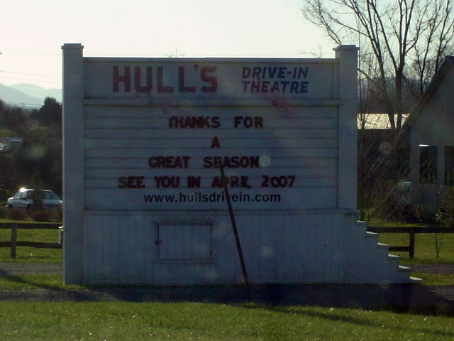
Interstate #32 in Andover, Va., Dec 1961, from the M. Gilmore Collection


Communities the railroad traversed along its route included Carfax, Maytown, Riverview, Tacoma, Ramsey, Hawthorne, Norton, Glamorgan, Dorchester, Needmore, Dooley, Josephine, Blackwood, Kelly View, Kent Junction, Appalachia, and Andover(main yard); and the coal camps of Roaring Fork, Pardee, Dunbar, Stonega, Wentz, Roda, Derby, and Dixiana.


Much of the railroad's original route still exists from Tacoma and points west as part of Norfolk Southern's operation in the area. The eastern portion was removed to the junction at the Clinch River, a large segment today constituting a rails to trails area in the Guest River Gorge. This area features the Swede Tunnel and an original trestle that crosses the Guest.
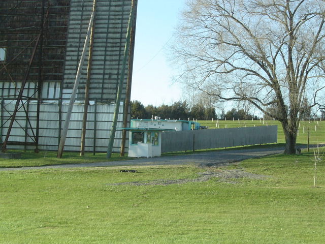
The railroad's operations were merged along with those of the Southern Railway into the Norfolk Southern Railway on October 31, 1985.
Web Resources
Appalachian Railroad Modeling(I found this site to be especially interesting)

InterstateRailroad.net

Southwest Virginia Museum

Interstate Car 101